نظام تتبع المركبات
منصة إدارة الأسطول
الحل
إحدى خدماتنا الأساسية هي تطوير نظم المعلومات الجغرافية (GIS) لمساعدة العملاء في إدارة أسطول النقل الخاص بهم. يمكن لنظام GIS تخزين كميات هائلة من البيانات لحل المشكلات المعقدة والقضايا التي يصعب التعامل معها. خبراء التصميم و البرمجة قدموا لعملائنا حلاً متكاملاً لإدارة أسطولهم، معتمدين على أحدث التقنيات لتلبية احتياجاتهم الخاصة.
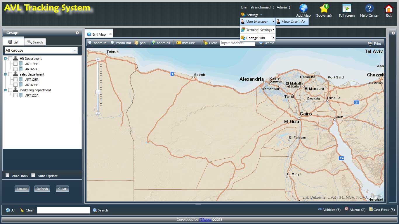
النظام هو نظام تتبع موقع المركبات الآلي (AVL) ويتكون من جزئين وظيفيين: بوابة المراقبة ووحدة الإدارة.
تعرض بوابة المراقبة تتبع المركبات في الوقت الفعلي على الخريطة، مواقع المركبات، والبيانات الأخرى ذات الصلة التي تم تحديثها عبر الإنترنت
تتضمن الميزات الهامة التالية :
تردد تحديث النظام القابل للتحديد من قبل المستخدم والذي يتم دائمًا في الوقت الفعلي.
يسمح بالوصول لعدة مستخدمين ويتيح لكل مستخدم استخدام النظام بشكل مستقل.
المعلومات المعروضة على كل شاشة هي معلومات محدثة ومتزامنة مع جميع المستخدمين الآخرين.
كل جهاز كمبيوتر مسجل الدخول باستخدام تقنيات المتصفح القياسية قادر على مراقبة جميع الأجهزة أو مجموعة فرعية منها.
لا يوجد حد لعدد المركبات التي يتم مراقبتها وعرضها.
تتيح وحدة الإدارة للمشرف القدرة المركزية لإنشاء وصيانة سجل الأصول للمركبات والأصول.
تتمتع الوحدة بالميزات التالية:
تدعم ربط وتحرير عدد غير محدود من السمات للمركبات والأجهزة والأفراد التابعين للوكالة.
تتيح لمشرفي النظام تنفيذ الأمان من خلال تكوين النظام للسماح فقط للأفراد المصرح لهم بالوصول إلى النظام.
يدعم نظام إدارة الأسطول القدرة التالية:
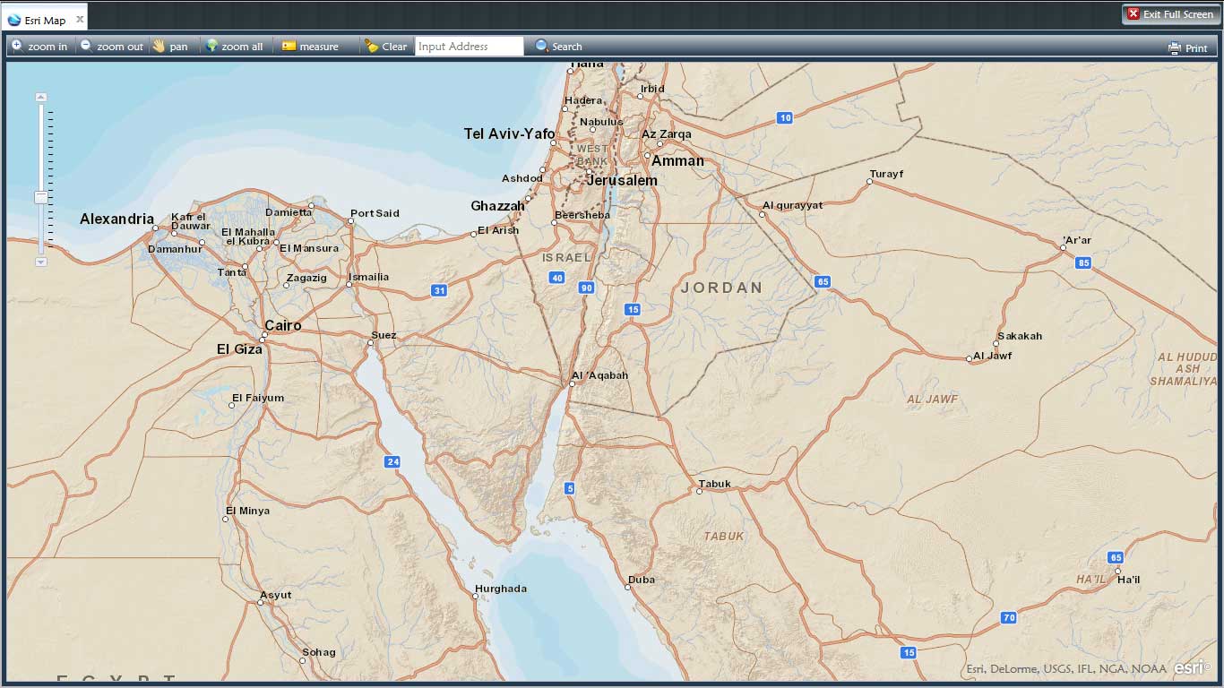
وضع العرض على الشاشة الكاملة
اختيار السمة
وضع متعدد اللغات (يدعم التنسيقات من اليمين لليسار ومن اليسار لليمين)
الوظائف الأساسية لنظام المعلومات الجغرافية (GIS) تشمل:
- التكبير/التصغير، التحريك، والعرض الكامل
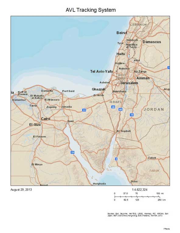
- الطباعة
- صندوق أدوات القياس
- مسح الخريطة
عمليات البحث تشمل البحث عن:
- مدينة/محافظة/حي
- شارع
- خدمة/معلم
- موقع مركبة محددة
وحدة الإشارات الجغرافية (Geo-Book Mark)
خيارات التتبع:
- تتبع مركبة واحدة
- تتبع عدة مركبات
- إعادة تشغيل تاريخ التتبع
إخطار المستخدم من خلال تنبيه على صفحة الويب وإرسال بريد إلكتروني/SMS عندما:
- يتم تجاوز حد السرعة
- الدخول إلى/الخروج من السور الجغرافي المحدد (Geo-Fence
تنبيهات أخرى محددة بناءً على ميزات جهاز GPS (مثل: بطارية المركبة، حزام الأمان، إلخ).
وحدة تنبيهات السور الجغرافي (Geo-Fence):
-تنبيه عند الدخول إلى/الخروج من السور الجغرافي
- تحرير سهل لحدود السور الجغرافي
التقارير والرسوم البيانية
- الوصول إلى تقارير القيادة اليومية أو الشهرية للثلاثة أشهر الماضية
- التقارير الدورية القياسية تشمل:
- إجمالي الوقت المنقضي في السفر (لكل رحلة، فترة)
- السرعة القصوى المسجلة (لكل رحلة، فترة)
- السرعة المتوسطة المسجلة (لكل رحلة، فترة)
- تقرير تفاصيل الرحلة
تقارير الاستثناء
- قائمة وتفاصيل حوادث السرعة (الجهاز، السائق، الموقع، السرعة) لكل مجموعة/فترة
- قائمة وتفاصيل انتهاكات السور الجغرافي (الجهاز، السائق، الموقع) لكل مجموعة/فترة