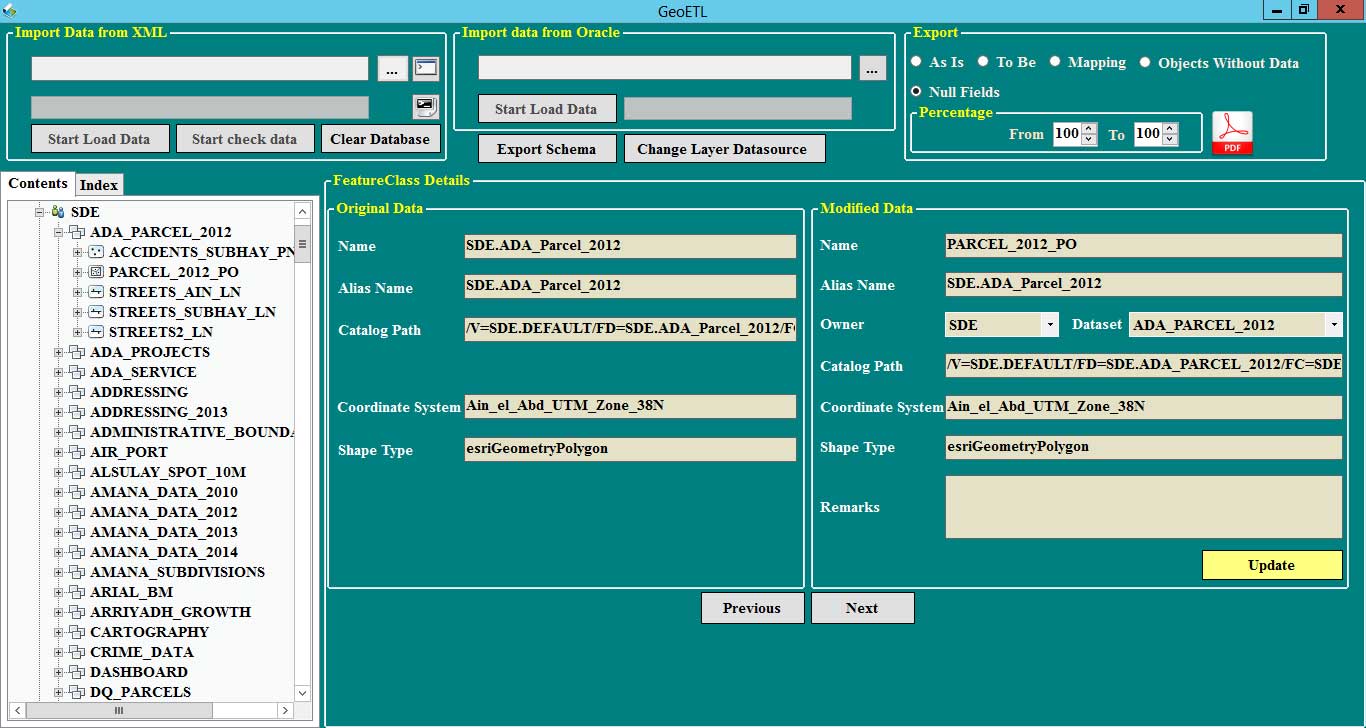
The GEO ETL, short for Extract-Transform-Load, is a geo-processing application that extracts, transforms, and loads relevant geographic data from various data models and in different file formats. It is designed to automate data migration and modify data model, while showing mapping between old and new data model and generating python script to transfer data from old to new data model.
The main features of GEO ETL include:
Ability to connect to SDE-exported XML schema and compare data to Oracle.
Ability to show data model in tree, with the same look and feel of ESRI ArcGIS for Desktop.
Modify schema by adding, updating, or deleting data.
Automatically eliminate null objects from previous or old data models.
Schema check and evaluation in terms of rule violation in objects naming (i.e. objects' name not in English or objects' name contains special characters).
Powerful search engine to find any objects in the data model.
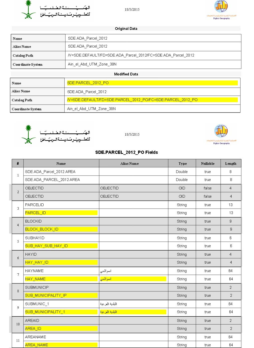
Generate PDF reports of the following data.
a. As-Is Data Model (Old Data Model) - shows Feature/ Tables metadata, Column’s definition, Indexes and relations.
b. To-Be the As-Is data model - shows data after applying user's modifications.
c. Mapping report - summarizes the modifications done on the data model and map between new and old data model.