
GIS IN DAILY LIFE
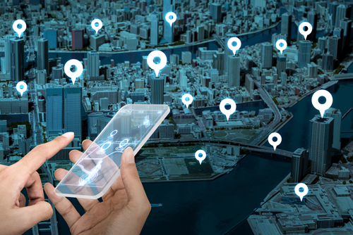
GIS refers to geographical information systems, it is the backbone for geographical science and all of its related fields. Through using a highly specialized technology, modern geography can manage to gather, analyze, and report on data about positions and locations on Earth’s surface. GIS data can provide a relevant and important information when it comes to location intelligence, like longitude, latitude, addresses, and zip codes of specific locations. It can also provide details about the people who live in a particular area including population size, education, and income levels, as well as environmental features of the landscape.in short, it can connect locations with all information needed. This type of data allows GIS scientists to be able to compare locations and draw conclusions based on the relationship between the different location data. At its most basic level, geographical information systems data is perfect for creating maps. But what about using GIS for people’s regular daily needs. GIS technology is now able to gather information about the people who live, work in particular areas as well, gathering and storing information like what people purchase, lifestyle, internet usage, and more.
USES OF GIS DATA IN EVERYDAY LIFE
It clearly now that GIS has real-world applications far beyond scientific curiosity, but some of the applications of GIS might be a surprise for you. Here are a few popular uses of using GIS in everyday life for location intelligence:
Urban Planning: GIS data can help both with the human side of urban expansion and the knowledge of the geographical area. For example, how should a city expand? What residents of certain area need more of? Are the outskirts of the city capable of sustaining more growth?
Agriculture: GIS is used today for analyzing soil data to help determining which crops would do best in certain areas. It is also helping farmers to maintain more efficient harvesting methods. As a result, society can be provided with increased food production and better environmental practices.
Navigation: Map applications that are used on smartphones and in vehicles rely basically on GIS data to keep their maps up to date. Consumers depend on these navigation systems to get them where they need to go safely and efficiently. Thanks for location intelligence.
Telecommunications: Telecom companies use GIS to plan and design their networks and keep on top of customer needs and maintenance planning. 5G mobile internet is the next amazing thing thanks to GIS and location intelligence.
Transportation: GIS can help answering many questions regarding transportation, from identifying risky intersections and improving road optimization, to choosing the proper location for a new road or rail routes.
GIS data is also used every day in other popular fields for example: education, health, real estate, public safety, retail, insurance, and manufacturing
Geo Sales Manager – Sales Force E-Supervisor (SFES) Solutions – ITRoots